
About the Geological Survey of Ireland historical geological maps website
This site displays a range of historical geological maps, sections and memoirs of the island of Ireland, mostly from the 19th century. This resource illustrates the painstaking original work undertaken by the pioneers of Irish geology and provides a readily accessible record of the progress of geological mapping in Ireland. The site has been developed jointly by the Geological Survey of Ireland, the Geological Survey of Northern Ireland and the British Geological Survey.
For up to date maps and publications visit Geological Survey of Ireland or Geological Survey of Northern Ireland for the areas they respectively cover.
List or search the various map series, memoirs and sections made available on the site. Memoir documents are provided for download in pdf format. Detailed scans of maps and sections are made available to view on line via the Open Source Djatoka Jpeg 2000 Image Server.
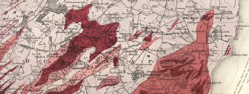
Extract from Sheet 130 Wicklow, one of the first one-inch sheets published in 1855. Click image to view map.
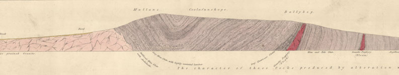
Extract from old series longitudinal section no. 1. Bilboa Colliery, Croaghan Kinshela to Arklow Rock. 1848. Click image to view section.